
Have you ever wondered what the future holds? Well, it's easier to know the past than it is to know the future. Welcome to the Country Club of Miami WorkGroup (CCMWG) website where we will try to keep you informed about what has happened and what will happen in your community. To see our future, please register on the this website. Registration is free, this is a non-commercial site sponsored by the CCM Workgroup. Once you register, you will be able to view the Miami-Dade County Parks, Recreation and Open Spaces Department's plans for our Golf Course. Your participation will amplify the voice of our community. After logging in, click here to see the future.
Membership on this website is limited to residents residents of the Historic Country Club of Miami Square Mile having the following boundaries:
| North | Theoretical NW 202nd St |
| South | Miami Gardens Drive - NW 186th St |
| East | Bob-o-Link Drive |
| West | Theoretical NW 77th Av |
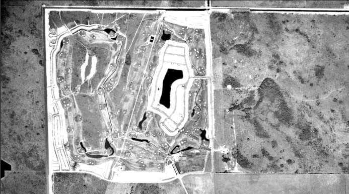
Here is a photographic,videographic and cartographic chronology of our subdivision. One thing is certain in life...change. Warning: this page may be slow to load. Here's an aerial shot of the way our subdivision looks today.

The Present
Our neighbor Acosta Oneil was able to capture an excellent video of the flood using a drone. The video was shot near the intersection of West Oakmont and Coldstream Drives.
Hurricane Eta on November 9, 2020
The past...Here's the way it was in 1963 when the number one song on the charts was Dominique by the Singing Nun and Andrew Wyeth was on the cover of Time Magazine.
The Way It was on December 27, 1963
Today, the CCM old South Course is a Miami-Dade County open spaces area. The bridge across the canal on Miami Gardens drive had not been built; there was no entrance to Palm Springs North from the North.
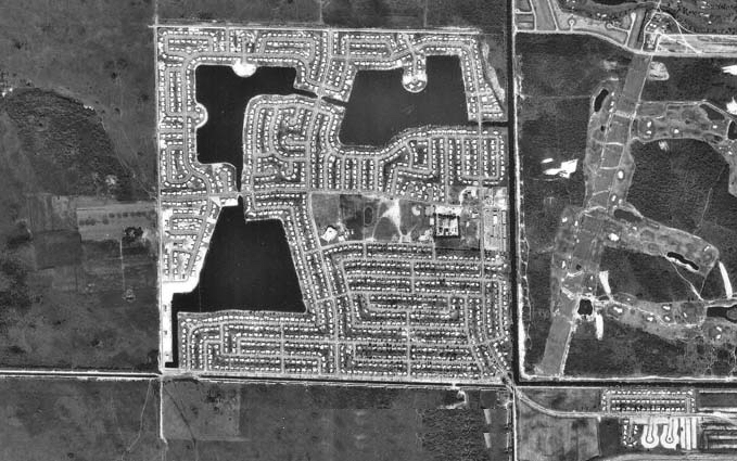
CCM Old South Course and Palm Springs North c. 1970
Back in the day we had our own airstrip. Much of the surrounding area was open space. The Royal Singapore Lakes TownHomes had yet to be built.
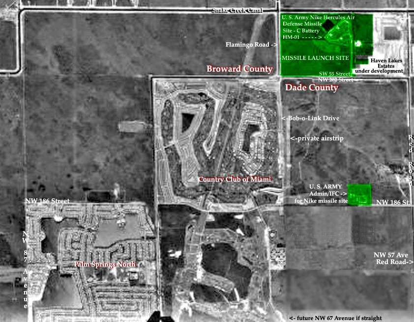
CCM and Surrounding Areas c. 1970
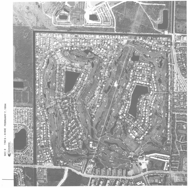
Here is an aerial photograph of the CCM subdivision in 1994. You can download a high resolution (41MB) version of this image at the bottom of this page.
Comments
RSS feed for comments to this post